
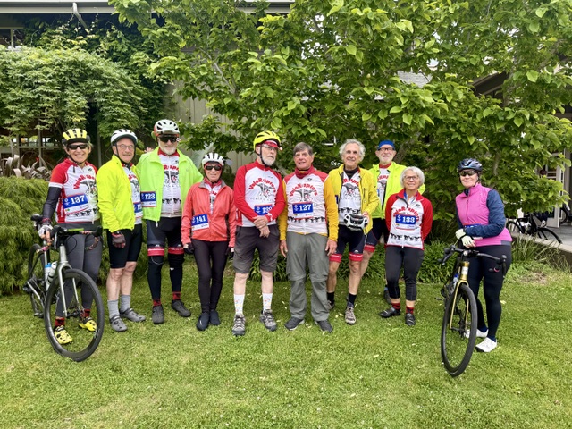
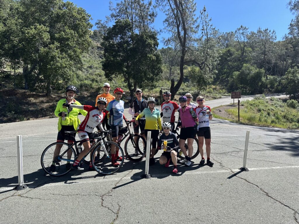
Six adventurous Hike-o-Raptors met at 9:00 AM on Memorial Day at the Clyde Woolridge staging area in Anthony Chabot Regional park. The weather cooperated with a cool, overcast day, so we didn’t have to worry about overheating.
Our route took us down the Jackson Grade to the stone bridge, where we turned south onto the Brandon trail. No-one was fazed by the steep climb up Cottonwood to Redwood Road. At the top, we turned north on Redtail trail and successfully located the “hole in the hedge” trail that appears on All Trails but not on the EBRPD map of Anthony Chabot park. This took us out to Redwood Road itself, where everyone followed strict instructions to walk in single file along the road for a few hundred yards. We then crossed the road to pick up Soaring Hawk trail on the east side of Redwood Road. Despite the low clouds, we still had breathtaking views of the San Leandro reservoir and the bay, so we stopped for photos and to enjoy the wildflowers. We then made our way down to Bort Meadow with its welcome bathrooms and picnic tables. Suitably refreshed, we were energized to ascend Buckeye trail to Goldenrod, which skirted Skyline, taking us to Jalquin and back to Clyde Woolridge. A herd of goats were busily chowing down on grass and weeds along the way, and we noticed in the adjacent area, where they had been the week before, that they’d eaten everything except the straw and poison oak.
We were exceedingly lucky with this hike – none of the tree work that had closed some of our route the previous week was underway. We saw very few other hikers – the cool temperatures must have convinced some to hike later in the day. We clocked 7.5 miles and 1260 feet of elevation gain, but no-one seemed to be challenged by the route. As an added bonus, we traveled some trails that were unfamiliar to some of the group. And the conversations were wonderful!


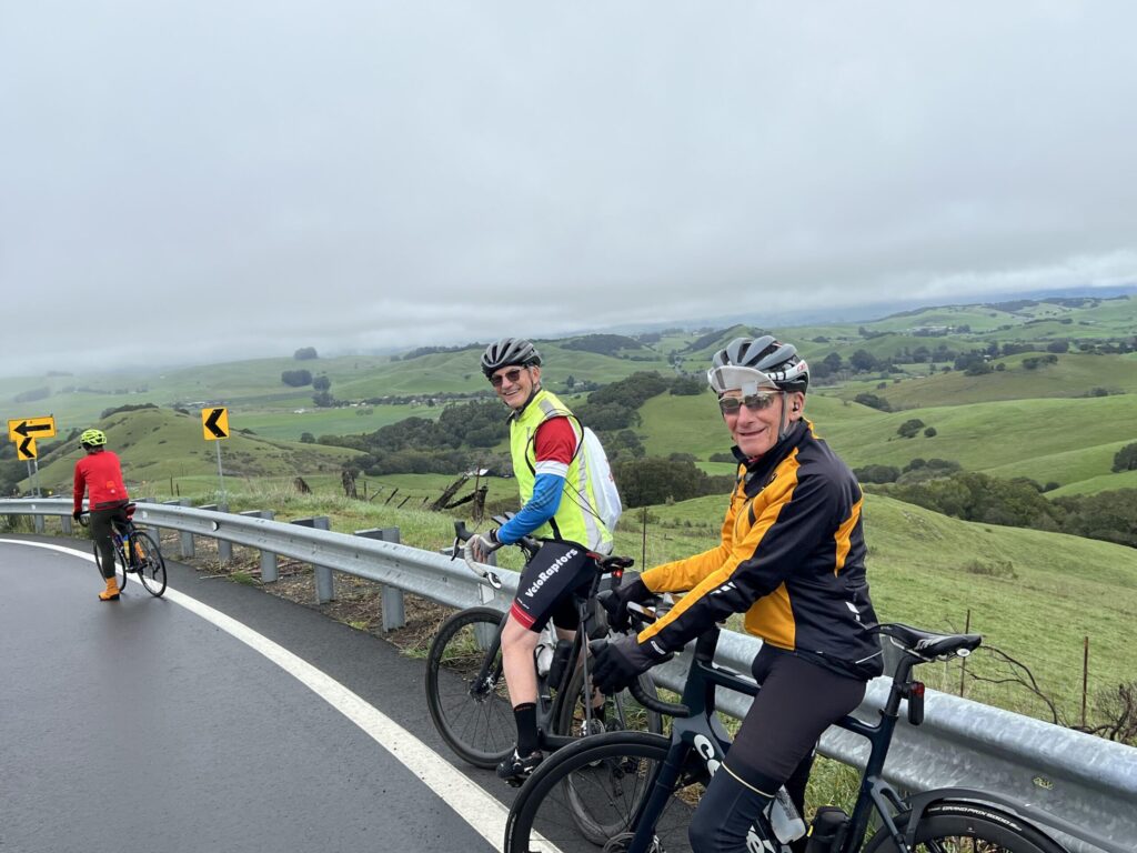
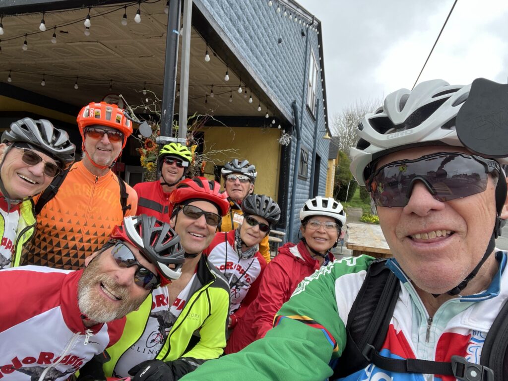
On a cloudy and chilly Sunday morning in May, BORP and the VeloRaptors had to supply their own sunshine and spirit for BORP’s annual Revolution Ride (the “Rev”). Starting from the Mill Valley Community Center, ten VeloRaptors assembled for the 8 AM start along a 41-mile route that includes the spectacular Marin Highlands ascent and the thrilling descent along the coast.
That loop leads seamlessly into the equally beautiful ride along the northern coast of the Bay, through Tiburon and following the Paradise Loop back to Mill Valley via a challenging uphill climb.
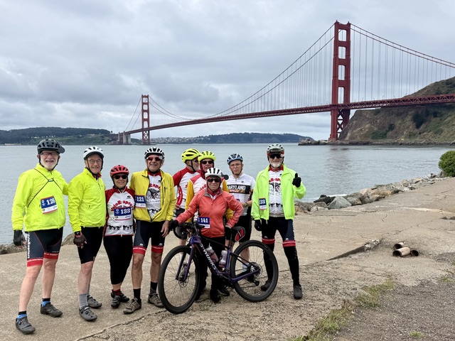
A second group of VeloRaptors started at 9AM to pursue the Tiburon-Paradise Loop route, including the aforementioned hill. After the ride, all enjoyed a hearty, healthy lunch and refreshments. A local band, based on an “Iko, Iko” Cajun sound, livened an afternoon that turned sunny.
In keeping with its longstanding support of BORP, VeloRaptors Cycling Club members were the 3rd in team fundraising with a total of at least $16,165 raised to support BORP and its vital programs for developmentally-disabled cyclists and other athletes. Overall BORP raised $220,000 through the 2026 Rev ride.
Here is part of the Thank You we received from BORP.
| Thank you for making this year’s Rev such a joyful, generous, and very BORP kind of day. This year’s Rev brought together 204 registered riders, more than 50 volunteers, and 1,132 peer-to-peer donations, raising over $220,000 and counting for BORP programs across the Bay Area. That number is worth celebrating, and it reflects so much more than dollars raised. It represents riders reaching out to friends and family, volunteers making the day run smoothly, donors giving from near and far, sponsors investing in BORP’s work, and a whole community choosing, once again, to show up. The Rev has never been just a bike ride. It is one of the ways this community keeps BORP moving and helps make sure people with disabilities across the Bay Area can find sports, recreation, adventure, confidence, and community. |
VeloRapters were a top 20 individual contributor with $1,650 in individual donations, plus a $2,500 corporate donation (thank you, Rick P.). The event had 400 participants this year and raised $213,000 for Oakland and Alameda schools.
And there were TWO VELORAPTORS THIS YEAR
The 110-mile ride was under cool weather with 4,761 feet of elevation. The route is pretty going through cow and solar farm country between the Benicia Bridge and Vacaville.
The cool weather turned out to be an asset. The ambience and support on the ride was amazing. I am sore but feeling good today.
Davis Rest Stop included olives, sushi, pickle juice, and chargers for iPhones and iWatches.
Thank you for your generous support. It really makes a difference.
Sincerely,
Rick
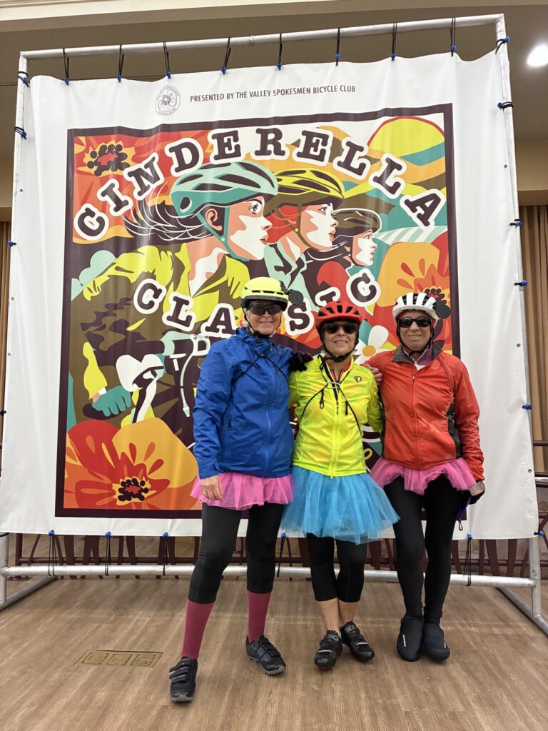
Pauline, Chris and Gail show that they can Brighten a Rainy Ride!
We had a wonderful hike planned for April, to enjoy spring flowers and green grass. Unfortunately, the weather did not cooperate. While we always need rain, it brings problems on hike days. Several VeloRaptors looked at the weather forecast and decided to change their plans.
Three hardy folks made of sterner stuff (Gail Y, Karen G and Fiona D) met at the Clyde Woolridge staging area, donned rain gear, and set off down the Jackson Grade. We immediately noticed that the trail was slick underfoot, so Fiona returned to her car to get poles. Appropriately equipped, we continued down to the stone bridge, enjoying the amazing scent of wet vegetation. As we proceeded south on the Brandon Trail, the mud got thicker – the stick to your boots kind of mud. We valiantly pressed on for a while further, when the mud got worse, and we decided that discretion is the better part of valor – the hike would be available in future, but we’d be able to enjoy it better without any broken bones or other injuries. Regardless, it was a nice walk retracing our steps. We had a fun 1.5 mile outing and look forward to doing the full hike later in the year.


Wednesday, April 8: A group of 11 intrepid VeloRaptors headed up Mt Diablo. They started in Walnut Creek, and took an intricate route through the neighborhoods that took them to the south entrance. They then proceeded up the south side and picked up another VeloRaptor at the junction, making a tidy dozen. After enjoying the view from the top they descended the north side, and midway down an agitated rattlesnake added a bit of extra excitement to their day. The first rider to pass the snake must have upset the creature, because it was coiled and ready for those that followed, even striking at one or two! Fortunately, downhill speed was to the riders advantage and no one was snake bit by the experience. Weather was perfect! Thanks to Kathy T. for organizing and leading this fun ride.


A couple of Wednesdays ago, I was cruising down Redwood Road toward Little Pinehurst with a bunch of VeloRaptors on our weekly ride. The road was dry and fast and my heavy bike was sailing along at about 25 mph, and as usual while descending, I felt no resistance when I turned my pedals. But then, starting up Pinehurst I also felt no resistance. Whoops, I thought – I somehow dropped my chain. Having no choice but to stop, I turned my bike over and saw the reason: there was no chain! I literally did drop it. John, one of my cycling buddies, came up behind me and quipped “I think you lost your chain back up the road.” Assuming my ride was over, I tried to call my wife for a ride home, but there was no cell service. My Lyft app didn’t work either.
I figured I’d have a long walk back to Skyline and Joaquim Miller and cruise home downhill. Just then a guy came riding down Pinehurst toward us. “Need anything,” he asked.
“Well, I lost my chain up the road there.”
“I’ll get it,” he said as he sped away up the hill as effortlessly as I had come down it.
I started the long walk home, but when I got to the old fire station, that same rider came toward me and casually commented “I found your chain . . . and I have a chain tool to fix it.” He showed his ‘quicklink’ tool and went to work. His name was Dave and he was riding from Castro Valley. We chatted about the campaign Bike East Bay was supporting to restore a bike lane that politicians were proposing to remove from the city’s bicycle plan. Within a few minutes he removed a broken link from the chain, put the chain back together, and had it back on my bike! “You know, I feel like I’m part of a bicycling community. I can’t thank you enough,” I said.”Well, yes. Your work with Bike East Bay contributes to that community, too. We each bring different skills to our hobby.”I couldn’t have agreed more, but I forgot to get contact info for Dave, so if you see him, let him know the repair worked and I got home safely. I now have a new chain and a heightened respect for the cycling community we share.
Tom Willging
VeloRaptor Cycling Club
Oakland, CA
For the past few years the VeloRaptors have organized a spring get-a-way, 3 days of biking around Paso Robles. This year was no different, and due to the popularity of the trip, we scheduled two groups that went down on successive weeks, March 22-26 and March 30-April 2.
Reports from the first week indicated that the weather was warm and the rides were great. The following week, the weather was a bit cooler – and was also great for biking’
Click to check out the blog post about the trip


The March Monthly Metric to the Greenest Green Ever on Morgan Territory happened in a most disjointed manner. The ride was scheduled for March 18, but ended up being postponed due to an unusual March heat wave. But with our upcoming excursions to Paso Robles, only a few folks ended up doing the ride, and on different days to boot. Here are their comments:
From Phillip G: Kurt and I had a great ride today – moderate temperatures, not much wind or traffic. And very green! Plus a few wildflowers, but not a ton. But, I’m sure it will still be very green for a Wednesday ride.
We found the water at Morgan Territory Staging Area – at the far left corner, next to the bathrooms.
Got a little surprise there – probably 20 or 30(?) Harleys and other big motorcycles in the parking lot, on a fundraising ride for colorectal cancer awareness. Our timing was great – they were heading north, so since our breaks coincided, we completely missed passing them in the opposite direction on the (narrow) road completely. Much safer and quieter!
Then a few days later – Fred M and Dale P did the ride. According to Dale: Fred and I had a gorgeous ride on the Morgan Territory loop Wednesday, and I’m happy to report it’s still as green as ever!!
Question: Would Fred have enough stories to entertain me all the way up the big climb?
Answer: Absolutely!! And then some!!!

The February Monthly metric covered one of the best bike rides in the Bay Area. Starting in Nicasio, the route heads north along the Nicasio reservior and then turns northeast toward Petaluma on Pt. Reyes-Petaluma road where one encounters the first climb. Once over the top, a nice downhill took us to the Nicasio Valley Cheese Factory for a pit stop. A half mile later we took a left on Hicks Valley Road and enjoyed to rolling hills of Marin. Hicks Valley Road ends at a T intersection with Marshall-Petaluma at the western base of Wilson hill – the second climb! This one is no joke, an even 10% grade that seems to never end. Dale and Steve are glad to be on e-bikes!
The descent down Wilson hill is fast and exhilirating! After a couple miles we turned left on Chileno Valley road which is just a great road to bike. It is just one pastoral scene after another for 14 miles and is mostly devoid of cars. We did see a few well behaved ag trucks
Chileno Valley road ends in another T at Tomales-Petaluma Rd and here we took a left turn toward Tomales.
Tomales is known among cyclists as the bakery there makes a great rest-stop. Unfortunately and unbeknownst to the ride leader, the bakery and deli both close on Tuesday and Wednesday during the winter months. But, there was a food truck and between that and the grocery store we made due. Here we are, repleat and ready to head out for Tomales Bay.
The weather during the ride to Tomales was overcast and cool, but the clouds started to dissipate when we reached Tomales Bay where the tide was OUT.
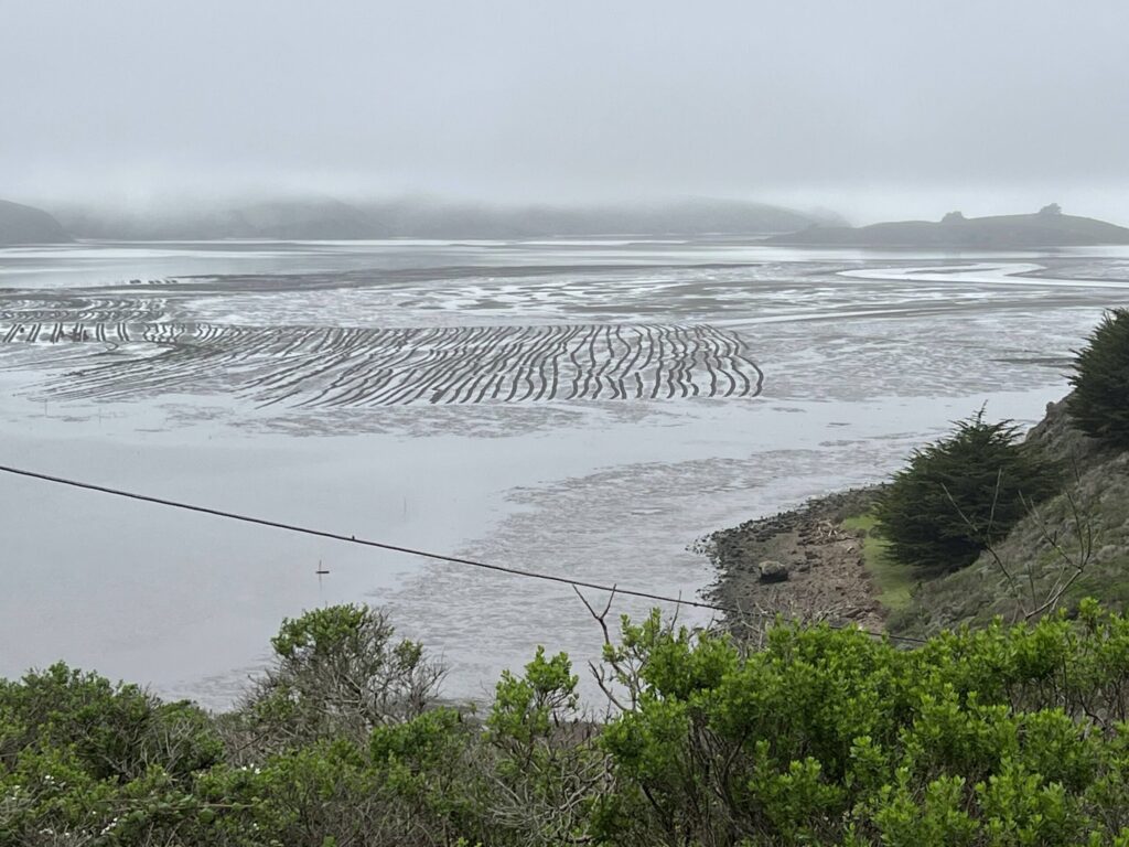
We had a fabulous ride down Route 1 and into Pt. Reyes Station for coffee and pastry at Toby’s, before pedaling back to the start in Nicasio.