Six adventurous Hike-o-Raptors met at 9:00 AM on Memorial Day at the Clyde Woolridge staging area in Anthony Chabot Regional park. The weather cooperated with a cool, overcast day, so we didn’t have to worry about overheating.
Our route took us down the Jackson Grade to the stone bridge, where we turned south onto the Brandon trail. No-one was fazed by the steep climb up Cottonwood to Redwood Road. At the top, we turned north on Redtail trail and successfully located the “hole in the hedge” trail that appears on All Trails but not on the EBRPD map of Anthony Chabot park. This took us out to Redwood Road itself, where everyone followed strict instructions to walk in single file along the road for a few hundred yards. We then crossed the road to pick up Soaring Hawk trail on the east side of Redwood Road. Despite the low clouds, we still had breathtaking views of the San Leandro reservoir and the bay, so we stopped for photos and to enjoy the wildflowers. We then made our way down to Bort Meadow with its welcome bathrooms and picnic tables. Suitably refreshed, we were energized to ascend Buckeye trail to Goldenrod, which skirted Skyline, taking us to Jalquin and back to Clyde Woolridge. A herd of goats were busily chowing down on grass and weeds along the way, and we noticed in the adjacent area, where they had been the week before, that they’d eaten everything except the straw and poison oak.
We were exceedingly lucky with this hike – none of the tree work that had closed some of our route the previous week was underway. We saw very few other hikers – the cool temperatures must have convinced some to hike later in the day. We clocked 7.5 miles and 1260 feet of elevation gain, but no-one seemed to be challenged by the route. As an added bonus, we traveled some trails that were unfamiliar to some of the group. And the conversations were wonderful!


We had a wonderful hike planned for April, to enjoy spring flowers and green grass. Unfortunately, the weather did not cooperate. While we always need rain, it brings problems on hike days. Several VeloRaptors looked at the weather forecast and decided to change their plans.
Three hardy folks made of sterner stuff (Gail Y, Karen G and Fiona D) met at the Clyde Woolridge staging area, donned rain gear, and set off down the Jackson Grade. We immediately noticed that the trail was slick underfoot, so Fiona returned to her car to get poles. Appropriately equipped, we continued down to the stone bridge, enjoying the amazing scent of wet vegetation. As we proceeded south on the Brandon Trail, the mud got thicker – the stick to your boots kind of mud. We valiantly pressed on for a while further, when the mud got worse, and we decided that discretion is the better part of valor – the hike would be available in future, but we’d be able to enjoy it better without any broken bones or other injuries. Regardless, it was a nice walk retracing our steps. We had a fun 1.5 mile outing and look forward to doing the full hike later in the year.


16 VeloRaptors and two dogs celebrated the Martin Luther King Jr. holiday with a hike in Redwood and Roberts Parks, starting at the Trudeau Center on Skyline Blvd in Oakland. We knew that there’d be a lot of hikers from the full car park and the “extra hike” getting to the meeting point from where we parked.
It was a glorious day – the kind that reminds you of how wonderful the Bay Area really is – and the absence of significant mud enhanced the experience. From the Trudeau Center we made our way to Dunn Trail, stopping to admire the blue-grey serpentine outcrop, and to inspect the tripping hazards created by unofficial drainage berms installed by guerilla park users (whatever happened to “take only photos, leave only footprints”?). We followed the Dunn Trail up, then down through open areas and bay-oak forest to Baccharis Trail (Baccharis pilularis is the Latin name for coyote bush), where we turned southeast to the junction with West Ridge Trail. Everyone was doing so well that no-one opted for the shortcut up Baccharis in the opposite direction.
Baccharis took us through a flat, open, sunny area with golden sandstone outcrops and sandy areas. Once on West Ridge, we were faced with a couple of steady uphill sections, which everyone handled very well. Three hikers then did the optional excursion to Redwood Peak before joining the others, who’d found sunny picnic tables in Redwood Bowl, near the restrooms.

From Redwood Bowl it was an easy downhill walk along Graham Trail back to Dunn, where we retraced the first part of our route back to the parking lot, admiring the stunning views of the bay. All in all, a very enjoyable morning!
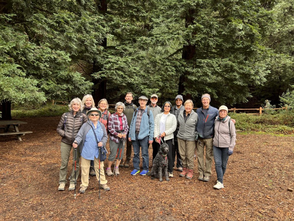
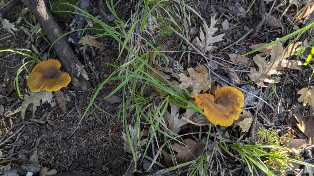
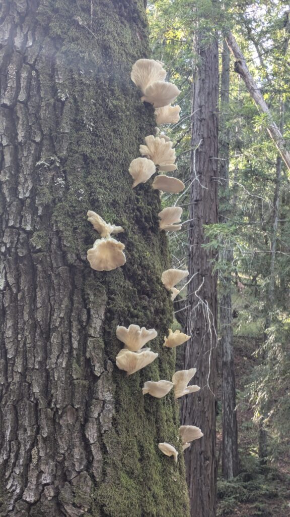
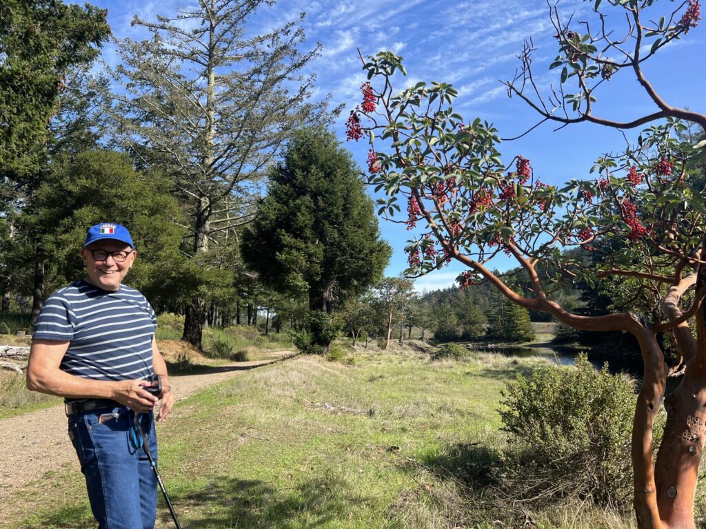
On Monday, November 10, nineteen Hike-O-Raptors ventured to Bon Tempe and Lagunitas Lakes, in a quiet part of Marin tucked away to the north of Mount Tamalpais. We knew that the day was going to be good when we discovered that Marin Water had suspended parking fees for the day. Everyone arrived early, and as planned, we started off around Bon Tempe Lake. The weather was glorious, with mild temperatures and bright sunshine. The only signs of it being fall were the long shadows, fallen leaves and a proliferation of beautiful mushrooms.
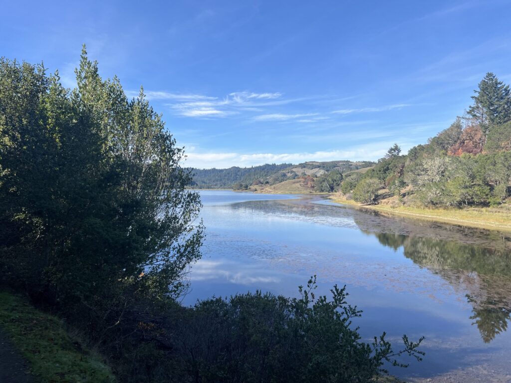
At the Bon Tempe dam we looked down on the western edge of Alpine Lake, the third reservoir in this series of Marin Water reservoirs – the Hike-O-Raptors had hiked down to the other end of Alpine Lake earlier in the year on the popular Cataract Falls trail.
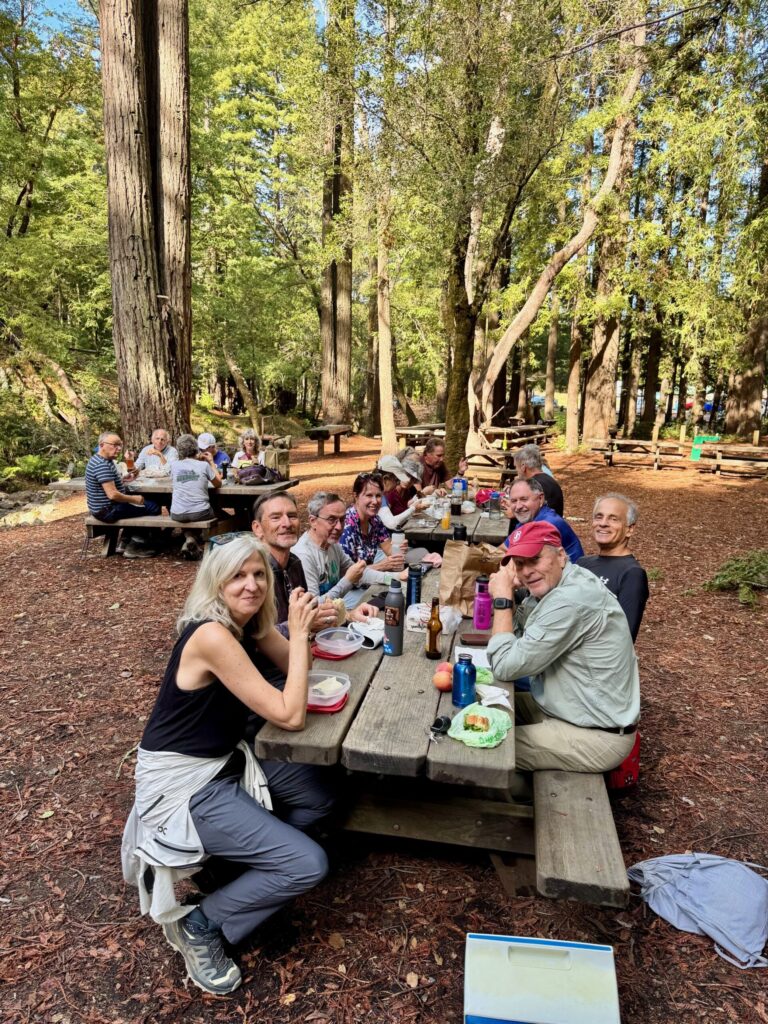
After making our way around Bon Tempe Lake – almost five miles – we appropriated the group picnic area and had a well-earned lunch.

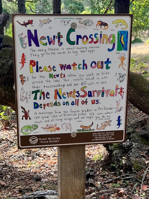
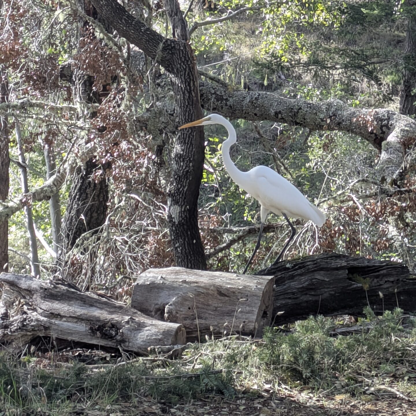
A few in the group had reached their limit at that point, while others did the only significant climb of the day up to the top of the Lake Lagunitas dam. We were rewarded with some fantastic wildlife – a couple of otters, an egret eating one of the newts that we were supposed to be looking out for, and squirrels’ larders in trees – and a wonderful end to a good day out with friends.
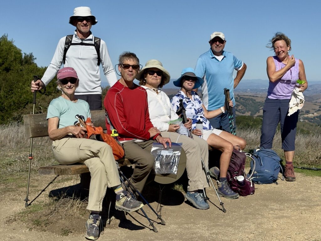
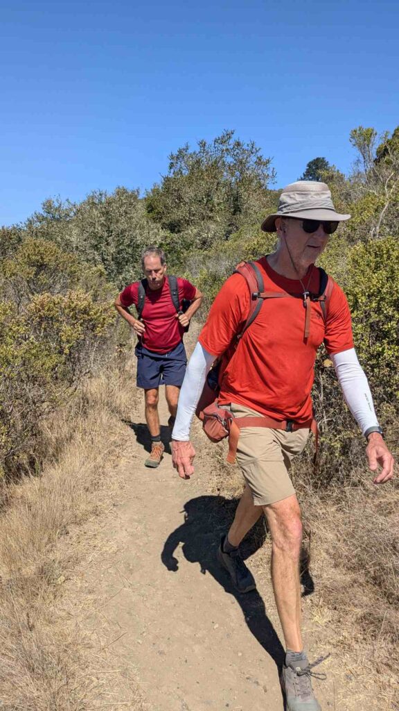
Eight HikeORaptors met in Briones Park on Monday, October 20, and hit the trail shortly after 9 a.m.
Alvin , Katie , Fiona, John, Karen , Marleen , Gary, and Jill
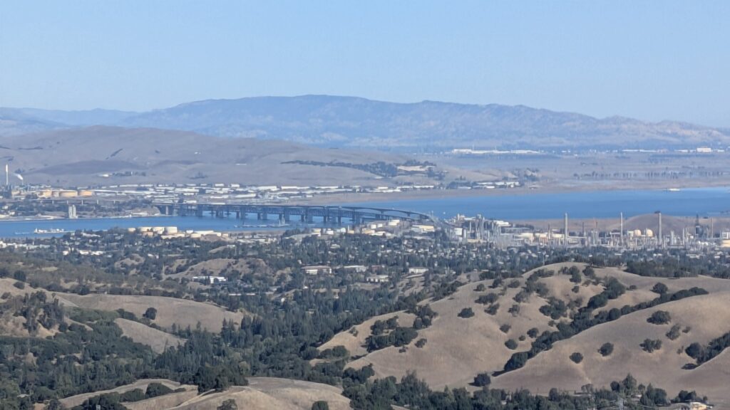
Due to an inattentive leader, the original route was extended by an additional mile, from the Bear Creek Staging Area up Abrigo Valley to Briones Crest Trail. Fortified by a snack at one of the most scenic benches in the park district, we proceeded to Table Top Trail, rejoined Briones Crest Trail, then descended on Seaborg back to the Bear Creek Staging Area. This route follows the crest of the hills (some ups and downs, quite steep!), and affords fantastic views – first of the Bay and delta, then over to Mount Diablo, and finally south.
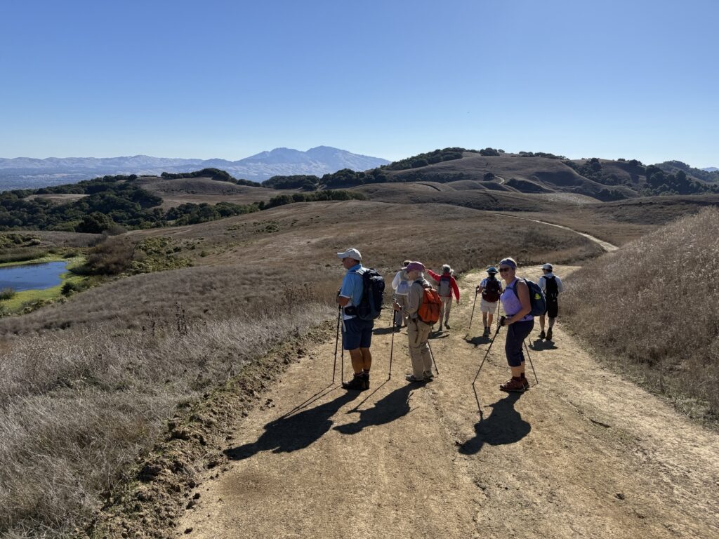
We totalled 7.7 miles with 1,135 feet of elevation gain. It was a glorious fall day, with enough of a breeze to temper the warm temperatures.
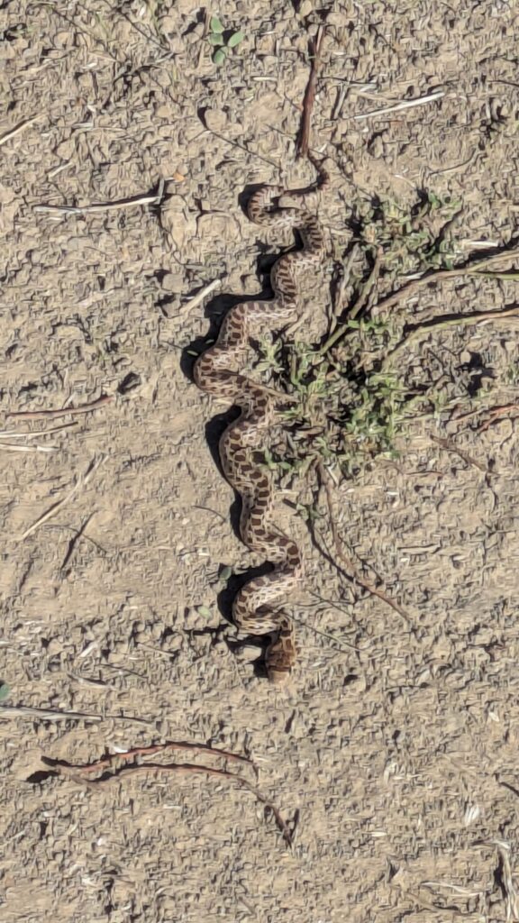
The wildlife included coyotes, a snake, a new calf (maybe not wildlife), and some amazing raptors.
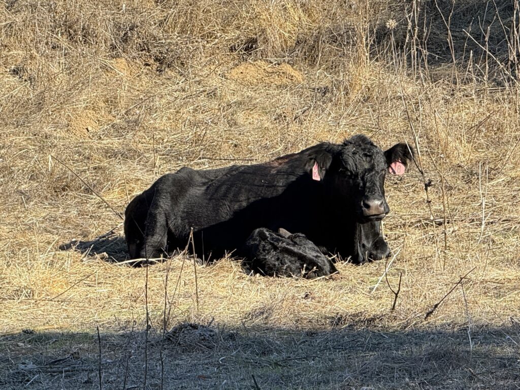
We noted the ponds where newts come to mate in winter, but there was no sign of them on this warm October day.
All in all, a good time was had by all.
Hello fellow VeloRaptors (HikeORaptors),
This is a recap regarding the hike at Tilden Regional Park held recently.
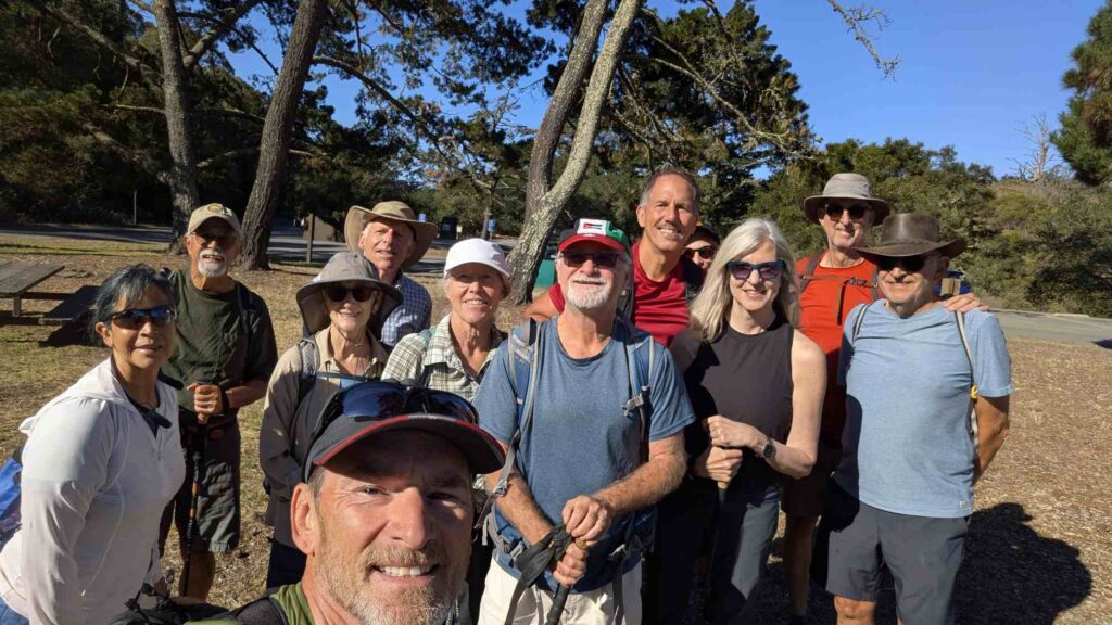
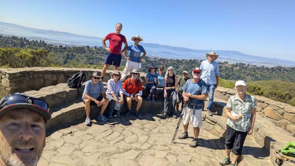
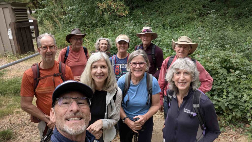
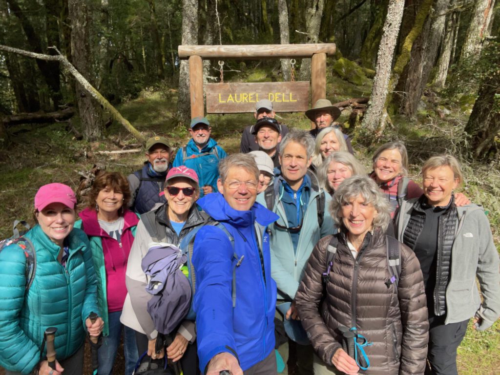
Alma L, Henk vA, Jill W, Richard S, Becky M, Scott M, David G (Phillip’s Brother), Kathy T (barely visible over David’s left shoulder), Sally M, Phillip G, Bertrand T, and Gary M pictured above. (Karen G not pictured here but attended too)
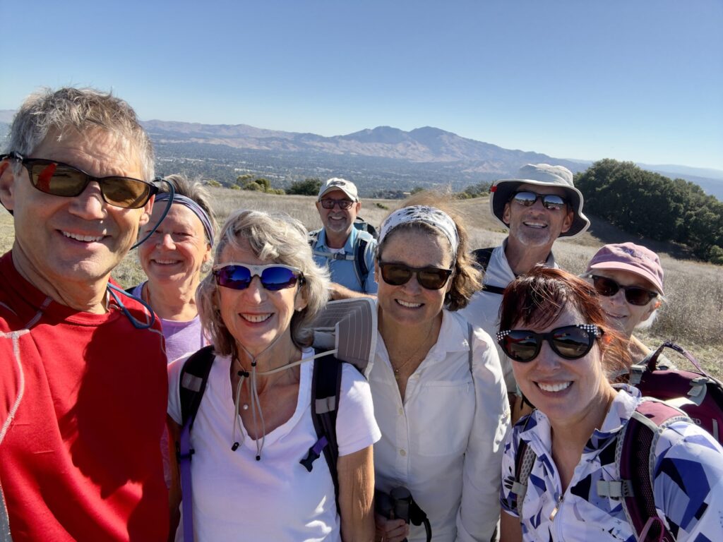
We had 12 members (and one guest) attend the hike on Monday 9/15/25 and we were ready to go by 9:40 from Inspiration Point in Tilden:
The first part of the hike was down the shady Curran Trail, then we connected with Wildcat Gorge up to the Dam / Spillway side of Lake Anza.
We took a minute to visit with each other at the lake and then continued our hike on the Selby Trail across the park.
We got to the Little Farm area of Tilden and took another break there. Refilled our water and used the bathrooms, then peeked into the bunnies, chickens, ducks, and pigs too.
The group was moving well and the temps were starting to get warm at this point, so we took our time getting to Jewel Lake (pretty dry this time of year), and took a break there too.
Next the sunny climb up to Wildcat Peak started.
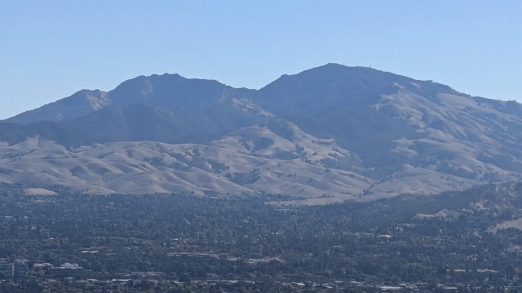
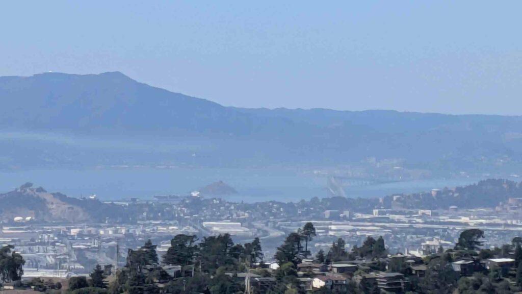
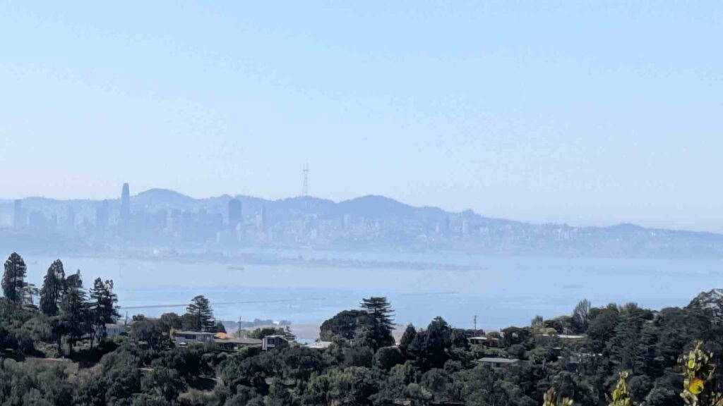
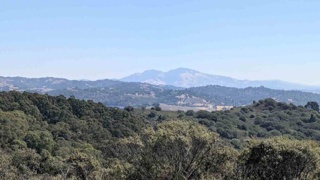
It was a beautiful clear day and we were able to see the S.F. Bay, Mt. Tamalpais, all bridges and islands, and then if you turned around there was Mt. Diablo.
Once we were done catching our breath and taking pictures from the top of Wildcat Peak, we started off for the redwood tree Rotary Peace Grove.
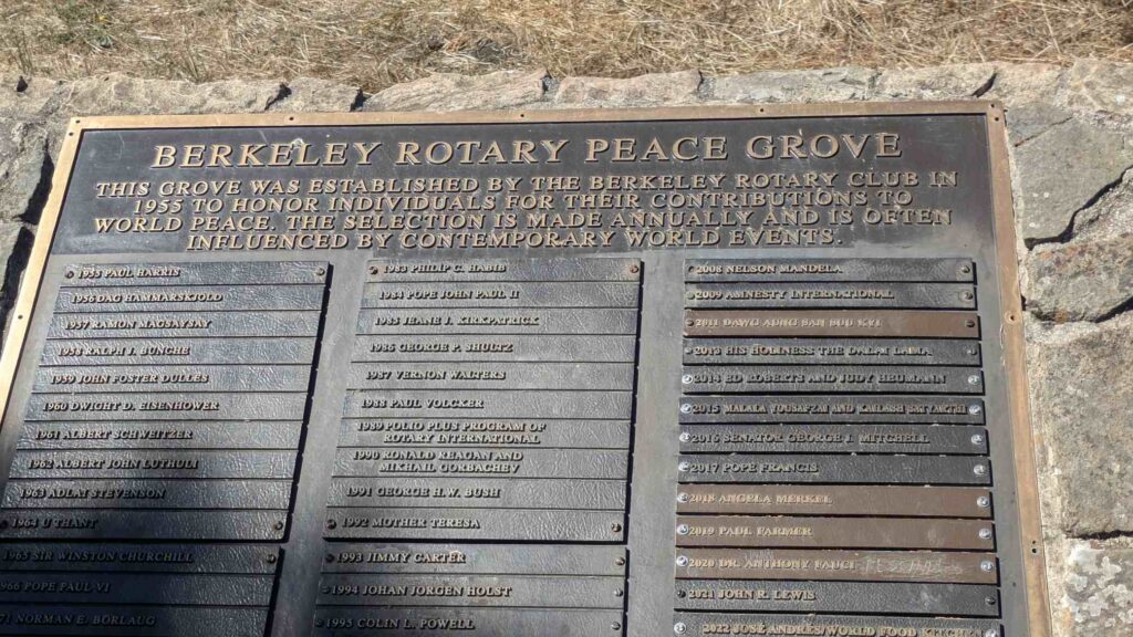
After reading all the interesting names on the monuments and enjoying the shade of the trees there we headed down to the last part of the hike on the asphalt Nimitz Way Trail back to the cars and a well deserved lunc
The complete hike took a little more than 3.5 hours (including multiple rests and picture stops), total distance of 7.85 miles and an elevation of 1120′ of climbing.
Monday’s weather started fine and by the end of the hike, had turned very warm, which made the trails not crowded since it was also a weekday!
Please keep an eye open for the next hike if the above description interests you; we will keep offering hikes all over the bay area as time and weather allows!
Thank you,
Gary McCormick
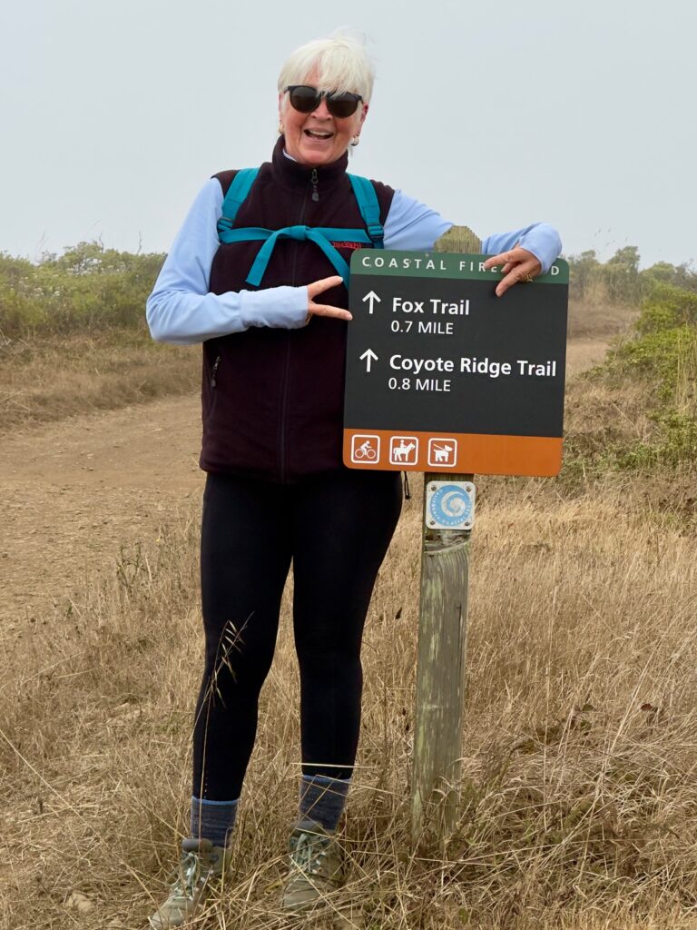
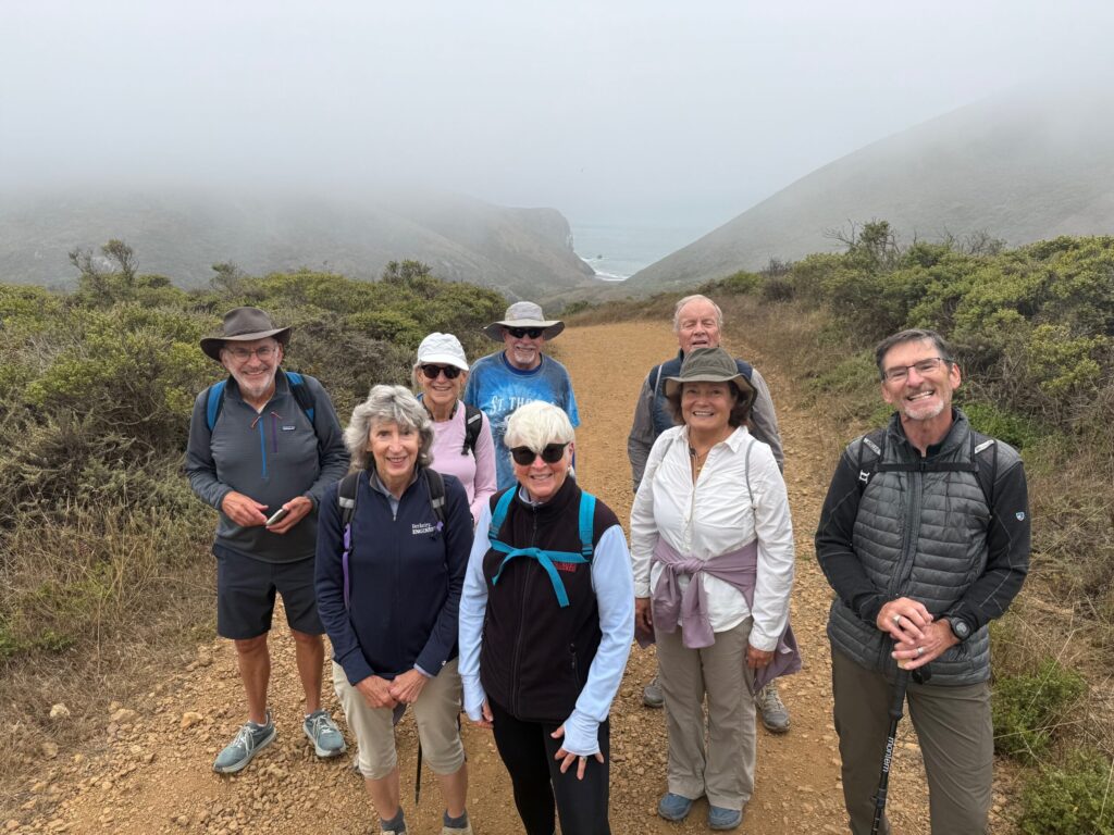
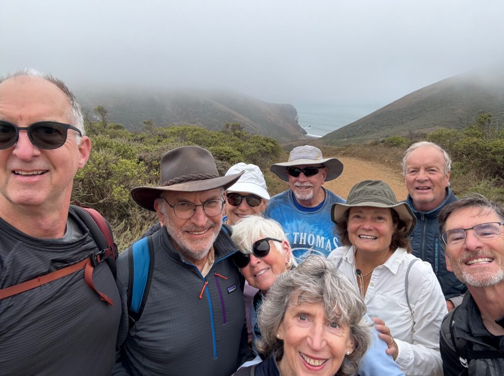
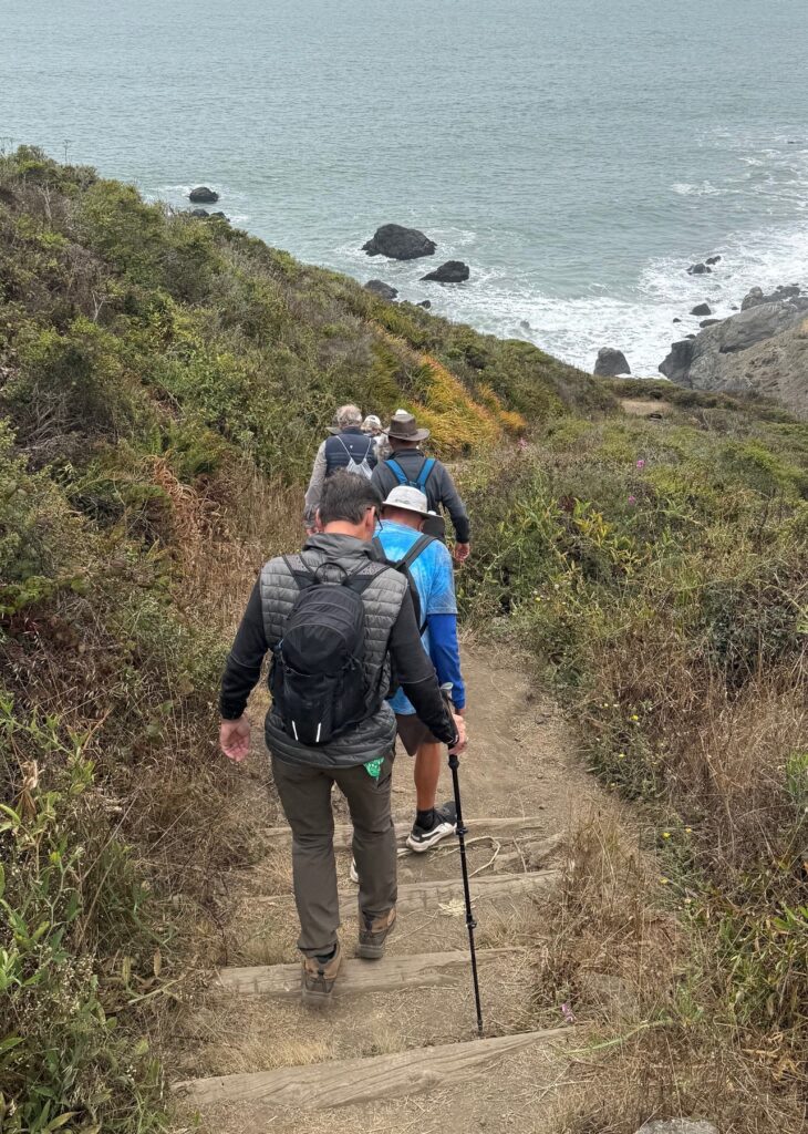
Nine intrepid VeloRaptors met at the Tennessee Valley Trailhead in Mill Valley at 10:00 AM for a coastal adventure, the Tennessee Valley Golden Gate loop, which is one of the top rated hikes in the area on AllTrails. The loop is about 5.5 miles long but has some steep ups and downs. Some points, where we descended steeply towards cliffs, weren’t for those who dislike heights!
We started with a gentle descent towards the ocean before heading uphill on the Coastal Trail. This led us up over cliffs with dramatic views of breaking surf, then down (steeply) to just above Pirate’s Cove. The trail then took us inland and uphill again, to just above Muir Beach. From there we took the Coastal Fire Road further uphill, before descending back on the Fox Trail. The sun never managed to break through the fog, so the sunscreen and hats weren’t needed on this outing!
Over lunch at the trail head we celebrated Gary’s birthday with lemon bars. The recipe for these will be appearing soon on the VeloRaptor Website!
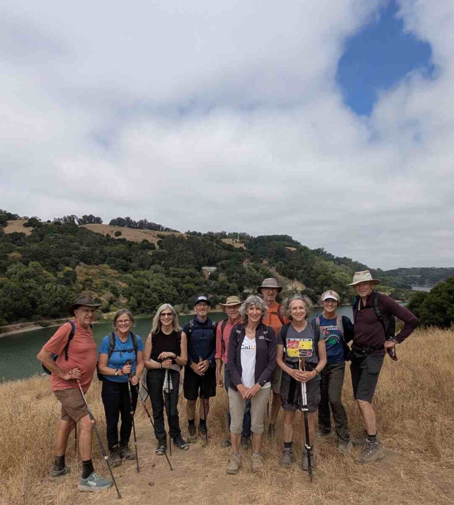
We had 10 members attend the hike and we were ready to go by 10:05 from the Proctor Staging Area off of Redwood Road in Castro Valley:
Phillip G, Bertrand T, Laurie S, Barbara M, Philip D, Richard S, Fiona D, Emily T, Sally M, and Gary M pictured above.
The first part of the hike was up to a beautiful rolling trail named Ten Hills Trail, then we picked up Indian Cove Trail where there was a bench and a great spot for pictures above the lake:
then down past much poison oak to the asphalt East Shore Trail and on to the Marina for lunch at the picnic tables there:
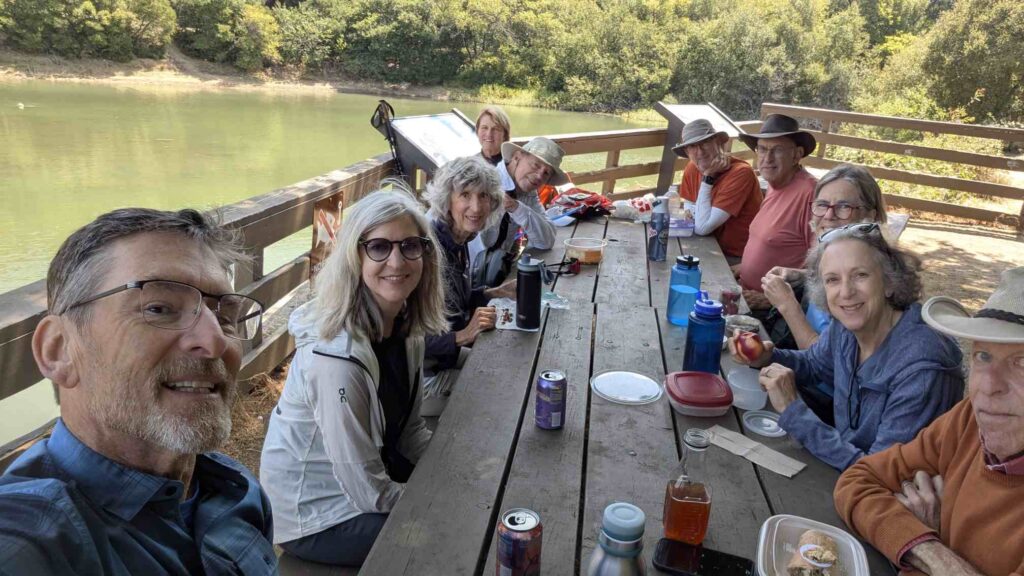
We shared cookies Laurie S. brought (so good, Thank You Laurie) and ate our packed lunches.
On the way back to the trail Phillip G. noticed that some blackberries were ripe and reachable, so we grabbed as many as we could find for an added dessert before we continued the hike.
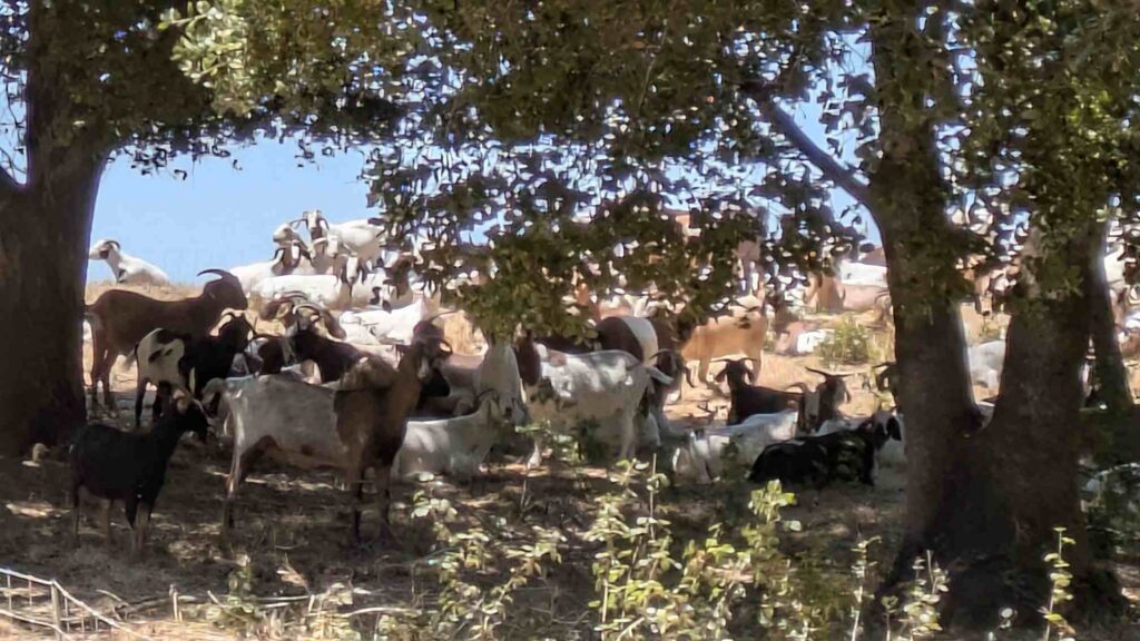
The hike back started along the asphalt East Shore Trail for a mile, then back to the dirt and we stayed right, past the bridge, then up, up, up on the Cameron Loop Trail. Once we got back to the top and met up with the Ten Hills Trail, we saw some goats that were clearing the hills of dry grass:
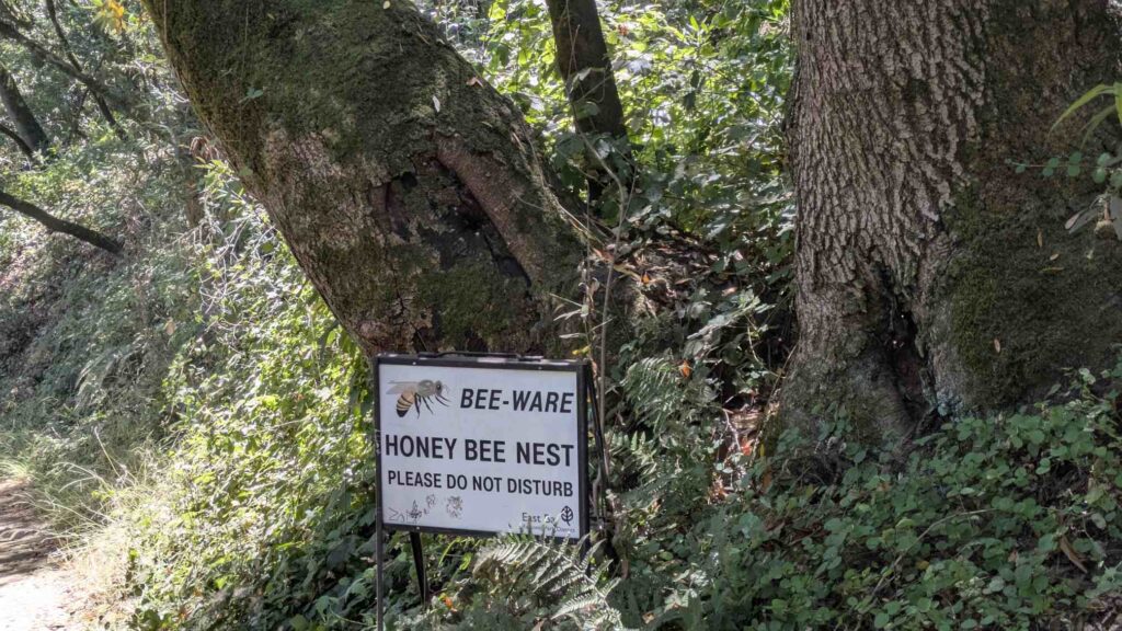
We then followed the Proctor Trail down and sneaked past the large Oak tree with an active honey bee hive on our way back to the cars:
The complete hike took 3.5 hours (including a couple rest and picture stops and then the lunch break), total distance of 6.75 miles and an elevation of 755′ of climbing. Friday’s weather was a beautiful day for hiking and the trails were not crowded since it was a weekday.
Please keep an eye open for the next hike if the above description interests you; we will keep offering hikes all over the bay area as time and weather allows!
Thank you for reading!
VeloRaptors Gary McCormick & Sally Mudd
On Presidents’ Day we ventured over the Richmond Bridge to the Cataract Falls Trail on Mount Tamalpais. This trail is spectacular after rain, and the weather obliged – plenty of water in the stream, but not too much mud. We started at the top at the Rock Spring Trailhead, made our way down the trail to Lake Alpine, where we enjoyed a well-deserved lunch, then climbed back to the cars, taking time to catch our breath/admire the cataracts on the way back up the hill.
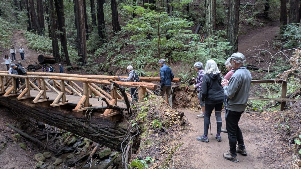
What better way to start a new year than to hike with the VeloRaptors? We followed a similar route to the October 2024 hike, but this time we “visited” the ladybugs wintering along Stream Trail, and tested the new bridge on Starflower Trail that has been constructed from a fallen redwood tree.